
The Hudson: A Modern Ecological History
By John Bulmer, Nor'easter Films
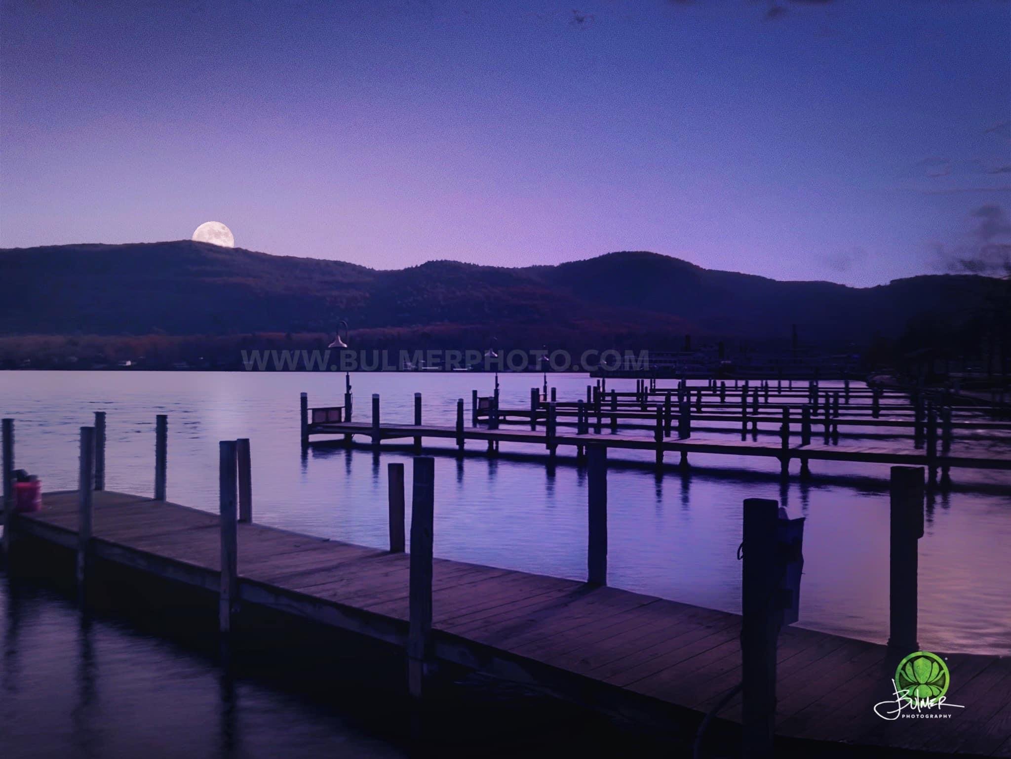
The Hudson River was originally known to the indigenous people of the region as "Muh-he-kun-ne-tuk," which means "the river that flows two ways" or "the river that flows both ways." This name referred to the river's unique tidal flow, which causes it to flow in both directions, north and south, depending on the tides. The river was later named the "Hudson River" by European explorers and settlers after the English sea captain Henry Hudson, who explored the river in 1609 while searching for a northwest passage to Asia. Hudson's exploration played a significant role in the European colonization of the region. The river of these early inhabitants of the Hudson Valley looked much different that the modern waterway we know today. It was clean, swimmable, and drinkable.
Over the past century and a half, the Hudson River has borne witness to a series of ecological challenges that have left an indelible mark on its once-pristine waters. From the rampant industrialization of the 19th century to the unchecked pollution and waste disposal of the mid-20th century, the river's resilience has been tested time and again. The construction of dams and the alteration of its natural flow for hydroelectric power generation disrupted aquatic habitats and migration patterns, while chemical pollutants and untreated sewage discharged into its currents poisoned aquatic life and contaminated its shores. Despite these adversities, determined conservation efforts have brought the river back. The effort to restore the Hudson's ecological balance continues to be an ongoing battle.
For several decades, the Hudson River has been at the center of countless endeavors to cleanse it from industrial waste and pesticides. Once a victim of rampant pollution from industrial discharges, sewage, and an array of contaminants, particularly during the mid-20th century, the river has become a testament to the power of human determination and environmental stewardship. Below is a timeline of the key initiatives in the effort to restore the Hudson and the ecosystems it supports.
1965 Pure Waters Bond Act
In a pivotal stride towards combating water pollution and elevating water quality across the state, the New York State 1965 Pure Waters Bond Act emerged as a formidable piece of environmental legislation. This landmark act, primarily geared towards mitigating water contamination, particularly in the Hudson River, emerged out of escalating concerns about the deterioration of water resources due to industrial and municipal pollutants.
The primary thrust of the Pure Waters Bond Act lay in the provision of financial resources earmarked for an array of projects designed to cleanse and safeguard water sources. This legislative masterpiece conferred the state with the authority to issue bonds, effectively furnishing the means to bankroll the creation and enhancement of sewage treatment facilities, water treatment plants, and associated infrastructure pivotal in reining in pollution and effectively managing wastewater. The overarching objective of these initiatives was to curtail the discharge of harmful pollutants into water bodies, notably the iconic Hudson River, thereby orchestrating a marked advancement in water quality.
With numerous communities indiscriminately releasing untreated or insufficiently treated sewage into the Hudson River, the bond act's financial support facilitated the upgrade of sewage treatment facilities. This strategic move played a pivotal role in minimizing the influx of untreated sewage into the river's waters. The act championed the cause of regulating and managing industrial discharges into the river. This endeavor encompassed the rigorous enforcement of stringent pollution control standards for industries operating along the Hudson River. In recognition of stormwater runoff as a principal perpetrator of water body pollution, the act earmarked funding for projects aimed at its management. By adopting measures to curtail runoff during rainfall events, the act acted as a bulwark against pollutants infiltrating the river.
The New York State 1965 Pure Waters Bond Act was an indelible cornerstone in the enhancement of water quality within the Hudson River and myriad other water bodies across New York State.
1972 Clean Water Act
In 1972, a game-changing piece of legislation was introduced: the Clean Water Act. It was a legislative triumph that enacted many important regulations aimed at curbing the onslaught of industrial pollution on the Hudson. Its provisions set forth a new era of accountability, reining in the unchecked discharge of pollutants into the river's waters while meticulously outlining benchmarks for water quality.
On October 18, 1972, Congress passed the Clean Water Act, overriding a veto by President Richard Nixon. The CWA established a comprehensive regulatory framework for controlling pollution in U.S. waters. Key provisions of the CWA include setting water quality standards, regulating pollutant discharges through permits, and establishing programs to address non-point source pollution. The Act established the National Pollutant Discharge Elimination System (NPDES) to regulate point source discharges (e.g., industrial and municipal wastewater) and the Total Maximum Daily Load (TMDL) program to address water bodies that didn't meet water quality standards. The CWA also provided funding for sewage treatment plant construction through the Clean Water State Revolving Fund (CWSRF) program.
The CWA has had a profound impact on water quality in the United States. It significantly reduced point source pollution and improved the health of many water bodies. Over the years, the Act has been amended several times to address emerging water quality issues, such as stormwater management, wetlands protection, and toxic substance control. The Act has also adapted to address new challenges, including climate change and invasive species. Enforcement of the CWA is carried out by the Environmental Protection Agency (EPA) at the federal level, with state environmental agencies often implementing and enforcing regulations under delegated authority.
Despite its successes, challenges remain in fully achieving the CWA's goals. Non-point source pollution, agricultural runoff, and urban stormwater runoff continue to pose challenges. Efforts to update and strengthen the CWA continue through periodic reauthorization and amendments, as policymakers seek to address evolving water quality issues.
PCB Clean-up: The Legacy of Industrial Pollution
A key benchmark in cleaning up the river was eradicating PCB (polychlorinated biphenyls) contamination, a legacy of General Electric's industrial footprint. These toxic chemicals are remnants of electrical equipment manufacturing. Polychlorinated biphenyls (PCBs) are human-made chemicals found in river sediment. PCBs bind tightly to sediment and other organic matter in aquatic environments. River flows and erosion redistribute the sediment, exposing the PCB-contaminated sediment to fish. Fish can become contaminated with PCBs by living near contaminated sediment or by eating contaminated prey.
The U.S. Environmental Protection Agency (EPA) and the New York State Department of Environmental Conservation (DEC) took the helm, orchestrating a comprehensive cleansing operation. The tainted sediments were dredged and disposed of in safe locations. The Environmental Protection Agency (EPA) periodically conducts comprehensive reviews of environmental remediation projects to assess progress, effectiveness, and adherence to regulatory goals. Those reviews are scheduled on a 5-year cycle, with one expected any day. The long-term effectiveness of dredging in reducing PCB contamination is debated. Some studies suggest that dredging may not always result in significant and lasting reductions in PCB concentrations, especially if the underlying sources of contamination are not addressed. The process can disrupt habitats, spread more contamination, and negatively impact aquatic life. Many in the conservation community await the EPA’s 5-year review in hopes of doing more to make the river swimmable again.
In 1983, the U.S. Environmental Protection Agency (EPA) designated a portion of the Hudson River, including the contaminated areas, as a Superfund site. This designation was a response to the severity of the contamination and the need for a comprehensive cleanup effort. The Superfund program aims to clean up the nation's most contaminated sites. Being declared a Superfund site means that a specific location has been designated by the U.S. Environmental Protection Agency (EPA) as a priority for cleanup under the Comprehensive Environmental Response, Compensation, and Liability Act (CERCLA) of 1980. Superfund is the common name for the Superfund program established by CERCLA. A site may be designated as a Superfund site if it poses a significant risk to human health or the environment due to contamination with hazardous substances, pollutants, or toxic chemicals. Contaminated sites can result from various activities, including industrial operations, chemical spills, and illegal dumping.
The contamination of the Hudson River with PCBs, a group of highly toxic and persistent chemicals, was first documented in the 1970s. General Electric (GE) had discharged large quantities of PCBs from its capacitor manufacturing plants in Hudson Falls and Fort Edward, New York, into the river over several decades, beginning in the late 1940s. The presence of PCBs in the Hudson River raised significant concerns about their impact on the environment, aquatic life, and public health. PCBs are known to be harmful to both aquatic ecosystems and human health, and they can accumulate in fish and other wildlife.
Environmental organizations, local communities, and concerned citizens advocated for the cleanup of PCB contamination in the Hudson River. Legal action was taken against GE, leading to a protracted legal battle. The cleanup of PCBs from the Hudson River has been one of the most complex and expensive Superfund projects in history. The remediation efforts have involved various techniques, including dredging contaminated sediments, capping, and other methods to contain or remove PCBs from the river. Even after extensive remediation efforts, ongoing monitoring is essential to ensure that the levels of PCBs in the river remain within acceptable limits and to assess the long-term effectiveness of the cleanup. Community input and involvement have been critical throughout the Superfund process, from the initial identification of the site to the development of cleanup plans and ongoing communication with local residents and stakeholders.
The cleanup of PCB contamination in the Hudson River has been a lengthy and contentious process, marked by legal disputes, public debates, and the complex engineering and environmental challenges of removing or mitigating PCBs from the river's ecosystem. While progress has been made in reducing PCB levels, the cleanup efforts continue to be closely monitored and scrutinized by environmental agencies, advocacy groups, and the public. The history of the Hudson River as a Superfund site highlights the challenges and importance of addressing long-term environmental contamination.
The Riverkeepers: Championing the Hudson
The emergence of Riverkeeper in 1966 gave a new voice to the call for environmental advocacy. Today, Riverkeeper is a non-profit environmental organization dedicated to the protection of the Hudson River and its tributaries, as well as the watersheds that provide New York City with its drinking water. Legal battles became its weapons, wielded to challenge the industrial polluters that once openly disposed of waste into the Hudson.
Riverkeeper's origins can be traced to a group of commercial fishermen, environmental activists, and local residents who were deeply troubled by the deteriorating conditions of the Hudson River. They recognized the urgent need for a dedicated guardian to protect the river and its ecosystems from the harmful impacts of industrial pollution and unregulated practices.
In 1983, John Cronin was appointed as the first Riverkeeper, a title that encapsulates the organization's commitment to vigilantly defending the river. Under his leadership, Riverkeeper began its mission to patrol the Hudson, investigate pollution sources, and hold polluters accountable for their actions. In its formative years, Riverkeeper was driven by a simple but powerful idea: the importance of citizen activism in defending the environment.
John Cronin was appointed as the first official Riverkeeper in 1983, and the title "Riverkeeper" epitomized the organization's commitment to vigilantly guarding the river and its tributaries against the threats posed by pollution and overdevelopment.
Riverkeeper's work in the 1970s was pivotal in exposing the illegal dumping of toxic chemicals and PCBs by General Electric (GE) into the Hudson River. This revelation brought widespread attention to the contamination issue, leading to legal action, public awareness, and, ultimately, the Hudson's inclusion as a Superfund site. This designation set in motion the arduous task of cleaning up PCB contamination, an ongoing process aimed at restoring the health of the river.
Riverkeeper's commitment to water quality and environmental protection extended beyond the Hudson River alone. Over the years, the organization expanded its mission to include other water bodies in the New York City area, recognizing the interconnectedness of regional waterways.
Their work encompassed diverse environmental issues, from habitat restoration and sustainable fisheries to climate change adaptation and environmental justice. Riverkeeper's engagement in scientific research and monitoring has been pivotal in assessing the health of water bodies and identifying pollution sources. Through educational programs, community events, and volunteer opportunities, Riverkeeper engages the public in conservation efforts. Their advocacy and policy work also aim to strengthen environmental protections, reduce pollution, and promote sustainable land use practices.
Today, Riverkeeper remains at the forefront of efforts to protect and restore the Hudson River and its surrounding water bodies. With a legacy of nearly six decades of dedication, the organization continues to be a powerful advocate for clean water, healthy ecosystems, and the preservation of New York's natural treasures.
Under the leadership of its current Riverkeeper, Paul Gallay, Riverkeeper's mission lives on, reminding us that clean and thriving waterways are not only essential for the environment but also for the well-being of our communities and future generations. Riverkeeper stands as a testament to the power of grassroots activism and the enduring commitment to environmental stewardship.
The Hudson River Estuary Program
A dedicated arm of the New York State Department of Environmental Conservation (NYS DEC), the Hudson River Estuary Program, emerged as a guardian of the Hudson River, encompassing not only the river itself but also its surrounding ecosystem. The program's mission extended beyond mere guardianship; it aimed to facilitate the river's renaissance, restore lost habitats, improve water quality, and engage communities as custodians of this shared natural heritage.
The Hudson River Estuary Program was established in 1987 through a collaborative effort between the NYS DEC and the Hudson River Foundation. Its inception was a direct response to mounting concerns about the environmental health and conservation of the Hudson River and the interconnected estuarine ecosystems. During its formative years, the program primarily focused on conducting extensive scientific research and comprehensive assessments of the Hudson River's ecological conditions. This included in-depth studies of water quality, the health of various habitats, and the status of fish and wildlife populations.
One of the program's standout initiatives has been its dedication to habitat restoration. It actively supported and funded projects aimed at enhancing the vitality of wetlands, rejuvenating shoreline areas, and facilitating fish passage within the expansive Hudson River watershed. Additionally, the program has played a crucial role in addressing pollution concerns and the enhancement of overall water quality within the estuary. This encompassed tackling issues such as stormwater runoff management, sewage treatment improvements, and regulating industrial discharges.
In more recent years, the Hudson River Estuary Program has shifted its focus towards adapting to the consequences of climate change. It has actively worked to safeguard the Hudson River's fragile ecosystems and the communities that rely on them from the threats posed by factors like sea-level rise and intensified storm events.
Both the NYS DEC and the Hudson River Estuary Program continue to collaborate closely with their partners in a shared commitment to protect, preserve, and enhance the Hudson River and its surrounding environment. Their combined efforts remain indispensable for the long-term sustainability and prosperity of this iconic waterway and its invaluable ecosystems. Through their dedication, they ensure that the Hudson River's legacy continues to flourish for generations to come.
Improving Wastewater and the Hudson's Brownfields
The modernization of sewage treatment plants along the Hudson River played a pivotal role in safeguarding the health and ecological integrity of the river ecosystem. This transformative step yielded a range of benefits that contributed to the overall improvement of water quality and the well-being of both the river and its surrounding communities. By preventing untreated waste from marring the waters, they offered a lifeline to the Hudson's reclamation.
Hudson River brownfields were identified through a combination of environmental assessments, historical research, and regulatory processes. The process of identifying brownfield sites involves examining areas that have a history of industrial or commercial activities, which may have resulted in contamination of the land and potentially pose risks to human health and the environment.
Hudson River brownfields refer to areas of land along the Hudson River that are abandoned, underutilized, or have been previously developed for industrial or commercial purposes but are now contaminated with pollutants or hazardous substances. These sites often have a history of industrial activities that have left behind environmental contaminants such as heavy metals, petroleum products, chemicals, and other pollutants.
Efforts to address Hudson River brownfields involve assessing the extent of contamination, developing plans for remediation, and implementing cleanup actions to make the land safe for reuse. The goal is to transform these once-polluted areas into functional and safe spaces that contribute positively to the surrounding communities and the environment. Brownfield redevelopment can range from creating parks and green spaces to constructing residential, commercial, or mixed-use developments.
Sewage treatment on the Hudson River has improved significantly over the years, resulting in cleaner and healthier water quality. These improvements are the result of a combination of factors, including legislative actions, technological advancements, and increased awareness of the importance of protecting water resources. Here are some key ways in which sewage treatment on the Hudson River has improved:
One of the most significant improvements has been the upgrade and modernization of wastewater treatment plants along the Hudson River. These treatment plants are responsible for treating domestic and industrial wastewater before it is discharged into the river. Upgrades have included the installation of more advanced treatment processes, such as biological nutrient removal and enhanced disinfection, which have resulted in cleaner effluent. Many older cities along the Hudson River, like New York City, have combined sewer systems that collect both sanitary sewage and stormwater runoff. During heavy rainfall, these systems can become overwhelmed, leading to combined sewer overflows (CSOs) that discharge untreated sewage and stormwater into the river. Efforts have been made to reduce CSOs through the construction of storage tanks, green infrastructure, and other mitigation measures. Enhanced Monitoring and Compliance: Regulatory agencies, such as the New York State Department of Environmental Conservation (NYS DEC) and the U.S. Environmental Protection Agency (EPA), have implemented stricter monitoring and enforcement measures to ensure that wastewater treatment plants are operating within permit limits. Non-compliance with discharge permits can result in penalties and mandated improvements.
Advances in wastewater treatment technologies have allowed for more efficient and effective removal of contaminants. This includes the use of advanced filtration systems, ultraviolet (UV) disinfection, and more sustainable treatment practices. Federal and state governments have allocated funding for infrastructure projects aimed at improving sewage treatment and reducing pollution discharges. These investments have supported the construction and rehabilitation of treatment plants, sewer systems, and stormwater management infrastructure.
While significant progress has been made in improving sewage treatment on the Hudson River, ongoing efforts are necessary to address emerging challenges, such as climate change impacts, population growth, and evolving water quality issues. Continued investment in infrastructure, research, and regulatory oversight will be essential to maintain and further enhance the water quality of the Hudson River and its tributaries.
Road Salt Pollution
Road salt also poses a potent threat to the health of our waterways. Road salt, primarily composed of sodium chloride (NaCl), can have significant negative impacts on freshwater sources when applied to roadways during winter for ice and snow removal. As road salt is spread on roads, it can dissolve in melting snow or rainwater, creating a salty runoff. This runoff, often referred to as "salt brine," contains elevated levels of sodium ions. When this runoff enters freshwater bodies such as rivers, lakes, and streams, it can increase the sodium content of the water.
In areas where freshwater sources are used for drinking water supply, elevated sodium levels can pose health concerns for humans. Excessive sodium intake can lead to health issues such as high blood pressure, particularly for individuals with certain medical conditions. Salt contamination also has adverse impacts on fragile habitats and vegetation. "Road salt is a looming crisis," adds Shapley. To mitigate the impact of road salt on freshwater sources, efforts are being made to use alternative de-icing materials, adopt smarter application practices, and implement technologies that reduce salt usage. These measures aim to balance the necessity of maintaining safe road conditions during winter with the need to protect the environment and freshwater ecosystems.
Road salt contains chloride ions, which, when applied to road surfaces, can be carried into the Hudson River through stormwater runoff. Elevated chloride levels in the river can harm water quality by increasing salinity. Excess chloride in aquatic ecosystems can negatively affect aquatic life, including fish and invertebrates, as well as plants adapted to freshwater conditions. In addition to chloride, road salt also introduces sodium ions into water bodies. Elevated sodium levels can disrupt the balance of ions in aquatic systems, potentially affecting the health and behavior of freshwater organisms.
The increased salinity caused by road salt runoff can be detrimental to aquatic organisms. Many freshwater species are not adapted to high salinity levels, and exposure to elevated chloride concentrations can stress or harm them. For example, it can impair the gill function of fish, making it more difficult for them to extract oxygen from the water. Road salt runoff can transport other contaminants from road surfaces into the Hudson River, including heavy metals, oil, and other pollutants that may be present on roadways. The interaction of road salt with these contaminants can have adverse ecological effects. Road salt can also accelerate corrosion of bridges, roadways, and vehicles. The runoff of corrosive saltwater into the environment can be detrimental to infrastructure and can contribute to the release of additional contaminants. Road salt contamination can persist in aquatic ecosystems for extended periods, as the salt does not readily break down or dissipate. Over time, this can lead to cumulative environmental impacts.
To mitigate these hazards, efforts are underway to find alternatives to road salt, improve salt application practices, and raise public awareness about the responsible use of deicing materials. Additionally, the development of winter maintenance strategies that reduce salt usage while ensuring road safety is a key goal in minimizing the environmental impact of road salt on the Hudson River and its watershed.
From the Source to the Sea: Lewis Pugh's Advocacy
Yet, in spite of all the advancements in protection and conservation, awareness campaigns, and improvements in technology and data collection, challenges linger.
The latest high-profile call for awareness of the plight of our fragile waterways comes in the form of endurance swimmer and ocean advocate Lewis Pugh. Dubbed the "Sir Edmund Hillary of swimming," he is the first person to complete a long-distance swim in every ocean of the world, and he frequently swims in vulnerable ecosystems to draw attention to their plight. Lewis Pugh, a modern-day adventurer and environmental activist whose extraordinary feats have captured the world's attention.
“The spotlight that Lewis is putting on the Hudson with this swim lets you imagine how Hudson would be once the PCBs are cleaned up. Swimmers like Lewis are the vanguard, showing us the need for clean water. With climate change, places with cool, clean water will be more important than ever for us to cool off.” says Dan Shapley, Senior Director of Advocacy, Policy, and Planning for Riverkeeper. For many directly tied to the health and safety of the Hudson, Lewis Pugh’s swim is an opportunity to educate a much broader audience to the challenges the river has faced in the past. “Lewis’ swim makes a big statement, giving the Hudson’s water quality world visibility,” Shapley said.
From braving frigid waters to advocating for marine conservation, Pugh's dedication to raising awareness about environmental issues is his driving passion. His latest effort was his astonishing swim from the source of the Adirondacks to New York Harbor, a journey that not only showcased his physical endurance but also shed light on the urgent need to safeguard our oceans and aquatic ecosystems.
Pugh began his swim at Lake Tear in the Clouds on August 13th reaching Battery Park on the tip of Southern Manhattan exactly one month later. While the waters in the remote Adirondacks remain pristine, the challenges of the Lower Hudson River are manifold, encompassing everything from sewage to industrial chemicals like mercury and pesticides. His swim remains unassisted, devoid of mechanized aid. He won't even be donning a wetsuit, choosing instead to sport a Speedo, swim cap, and goggles. This minimalist attire enables him to intimately sense the environment he traverses. Accompanying him is a team of six, which includes a cook and a safety kayaker who shadows him on the river, ensuring heightened visibility and his well-being as he journeys southward. Spanning a distance of 315 miles (507 km), the swim stands as one of Mr. Pugh's most formidable aquatic endeavors. Hailing from Plymouth, Devon in the United Kingdom, Mr. Pugh gained prominence for his 2007 swim across the North Pole, drawing attention to the alarming melt of Arctic sea ice. His achievements also include a 2018 feat of traversing the complete length of the English Channel.
Speaking from Glens Falls, Pugh reflected on his journey. "I was blown away by the source. It's a pretty special place," he remarked. "When you see a river like the Hudson, you think to yourself, this is what all rivers should be like," he continued.
As the UN's Patron of the Oceans since 2013, Pugh holds an optimistic outlook for the river's recovery. "This river gives hope. Yes, a lot more needs to be done, especially when it comes to raw sewage being released into the river. A lot more needs to be done, and it is a constant work in progress. It can take one generation to destroy a river, and it can take many generations to restore the river's health," Pugh explained.
Pugh's daily routine was both physically demanding and mentally invigorating. Spending approximately six hours in the water each day, he faced challenges like navigating around dams, waterfalls, and industrial structures. Many stretches of the upper river require him to traverse on roads or trails. The unwavering support of locals has became a vital source of encouragement for Pugh, with signs, cheers, and heartfelt gestures along the riverbanks fueling his determination. He remarked how he is genuinely touched by the support and encouragement of locals for his mission, some driving from as far away as Toronto. The support for his efforts grew in numbers his journey continued south toward New York City, passing through key urban centers in the Hudson Valley.
The encounters Pugh had with the people living along the river have left an indelible mark on him. He was moved by the deep generational ties that bind the locals to the river, and he expressed immense gratitude for the outpouring of support he received from communities across the state. While the journey carried him past stunning landscapes and smaller communities, Pugh acknowledged the greater challenges the river held south of Albany, New York, especially the more populous areas of the Hudson Valley.
"After rainfall, pollution becomes a concern, with combined sewage overflows and agricultural runoff affecting the water quality. Plastic pollution is also evident, lining roads and trails," Pugh lamented. The challenges of the Lower Hudson River are manifold, encompassing everything from sewage to industrial chemicals like mercury and pesticides. His swim was unassisted, devoid of mechanized aid. He chose not to wear a wetsuit, choosing instead to sport a Speedo, swim cap, and goggles. This minimalist attire enabled him to intimately sense the environment. A team of six accompanied him on this swim, including a cook and a safety kayaker who shadowed him on the river, ensuring heightened visibility and his well-being as he journeys southward.
Pugh found hope and inspiration in the Hudson's resilience. "This river is a testament to the care people have shown for generations. It's a constant work in progress, reminding us that it takes time and effort to restore a river's health," he affirmed.
"This river is more than just a waterway; it's a symbol of hope. It serves as a reminder that a river can be destroyed within a generation, but it takes the collective dedication of many generations to heal it. The Hudson River holds a special place in the hearts of not only New Yorkers but all Americans, as it flows through one of the world's greatest cities," Pugh concluded.
For decades, the battle to safeguard the Hudson River from the clutches of industrial pollution has raged on.
Dan Shapley, Senior Director of Advocacy, Policy, and Planning for Riverkeeper, highlighted the significance of Lewis Pugh's swim in casting a spotlight on the Hudson's future. "Swimmers like Lewis are the vanguard, showing us the need for clean water," Shapley emphasized. Pugh's swim becomes a medium to educate a broader audience about the river's challenges and the strides toward a cleaner future.
"While the Hudson’s source is pristine, the lower portions of the river are challenged by pollution. In the ADKs, the protection of the park is a conservation success in New York State. It is an enduring reminder to protect our headwaters,” commented Shapley. He also added, “The spotlight that Lewis is putting on the Hudson with this swim lets you imagine how Hudson would be once the PCBs are cleaned up.” Agricultural runoff and road salts pose increasing threats to water health. Shapley mentioned, “Sodium is a threat to our waters, and it is a slow-moving crisis.”
Efforts by organizations like Riverkeeper, a non-profit dedicated to protecting the Hudson River and its tributaries, demonstrated the power of advocacy and legal action against industrial polluters. Despite these achievements, challenges remain, including the need to address the impact of road salt on freshwater sources.
“Lewis’ swim makes a big statement, giving the Hudson’s water quality world visibility,” Shapley added. Lewis Pugh's extraordinary swim underscores the continuous demand for awareness and action. While substantial progress has been made, the journey towards a cleaner Hudson endures, driven by the voices of advocates and the river's own resilience.
In the past 150 years, the Hudson River has witnessed a remarkable transformation – from the depths of industrial pollution to the forefront of environmental awareness and advocacy. Through relentless efforts, dedicated advocates, and the advances in technology and understanding, significant strides have been made to protect this iconic waterway.
However, as we celebrate the victories achieved in the name of the Hudson, it is crucial to acknowledge that challenges persist. The river still grapples with issues like pollution from various sources, road salt contamination, and the ever-present threat of climate change. The battle to safeguard the Hudson River is far from over.
In the face of these ongoing challenges, advocates like Lewis Pugh, organizations like Riverkeeper, and countless others will continue to champion the cause of clean water. The Hudson River remains a symbol of resilience, a reminder that the work to heal our precious waterways is a journey of many generations. Together, we can preserve the legacy of the Hudson and protect the lifeblood of our communities, for it is not only a river; it is a symbol of hope, a testament to our commitment to safeguarding our natural treasures.
Portions of this story originally appeared in From the Source to the Sea: The Lewis Pugh Interview from Adirondack Mountain News.
Additional Reading:
Lewis Pugh: www.lewispugh.com
Lewis Pugh Foundation: www.lewispughfoundation.org
Riverkeeper: www.riverkeeper.org
Hudson River Estuary Program: www.dec.ny.gov
Environmental Protection Agency Hudson Superfund Site: www.epa.gov
@2023 John Bulmer Media. All Rights Reserved.
© 2023 Nor’easter Films. All Rights Reserved.